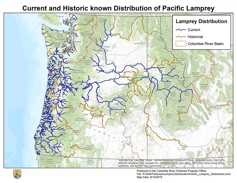
This statewide data and GIS infrastructure project developed standardized barrier assessment tools specifically for Pacific lamprey to complement existing salmonid-focused assessments in California’s Passage Assessment Database. Work included creating historical and current distribution GIS layers, defining lamprey-specific data fields, and developing a standard barrier assessment form. The project directly supports prioritization of barrier removal to aid Pacific lamprey restoration across California, where current distribution is estimated at roughly half the species’ historical range due largely to impassable dams and water infrastructure.
Location: Statewide, California. This is a data and GIS infrastructure project rather than a site-specific restoration project. The resulting distribution layers cover Pacific lamprey across California stream systems and are intended to feed into the statewide California Passage Assessment Database (PAD), A statewide inventory of fish passage barriers maintained by Pacific States marine Fisheries Commission (PSMFC) and the California Department of Fish and Wildlife.
Historical Fish Presence: Pacific lamprey (Entosphenus tridentatus) are found across anadromous drainages throughout California, with current distribution estimated at roughly half their historical range. Major river systems with historical presence include the Klamath-Trinity, Eel, and Sacramento-San Joaquin rivers, though large runs have largely disappeared from many of these. Construction of impassable dams and other man-made structures is the primary driver of range contraction, though lamprey have shown some capacity to naturally recolonize streams where barriers are removed.
Project Lead: Western Fishes (Principal Investigator: Stewart Reid), in partnership with the U.S. Fish and Wildlife Service Arcata Fish and Wildlife Office (Principal Investigator: Damon Goodman, Pacific Lamprey Conservation Initiative).
Project Partners: Pacific States Marine Fisheries Commission (PSMFC) and the California Fish Passage Forum’s Science and Data Committee.
CFPF Funding: $20,000
Project Description: The purpose of this project is to develop a standard PAD barrier assessment for Pacific lamprey that would complement existing assessments focused on salmonids, to prioritize barrier removal to aid Pacific lamprey restoration efforts throughout California. The project was structured in four tasks: (1) develop a historical Pacific lamprey distribution GIS layer; (2) develop a current Pacific lamprey distribution GIS layer; (3) define Pacific lamprey-specific data fields for barriers in the PAD; and (4) develop a standard barrier assessment form.
Expected Completion: Fall 2017
Project Effectiveness: Subsequent CFPF-supported work built directly on this project’s products, applying the GIS layers and PAD fields as management tools for barrier assessment and optimization of remediation strategies for Pacific lamprey.