This project removed a concrete-encased abandoned sewer line from the bed of Ross Creek in San Anselmo, Marin County, that had been acting as a 3.5-foot weir and barrier to juvenile steelhead and smolts, restoring natural channel grade and opening 8,000 linear feet of upstream spawning and rearing habitat in a tributary to Corte Madera Creek.
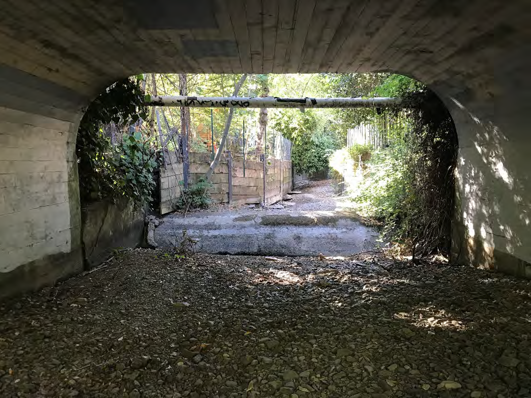
Location: Ross Creek immediately upstream of Shady Lane Bridge in San Anselmo, Marin County. Ross Creek joins San Anselmo Creek approximately 700 feet below the project site to form Corte Madera Creek, which flows to San Francisco Bay.
Historical Fish Presence: Ross Creek supports steelhead trout (O. mykiss) and coho salmon, as well as threespine stickleback. The creek has been subject to temperature monitoring by Friends of Corte Madera Creek Watershed since 2008, which documented summer water temperatures too warm for steelhead in reaches downstream of Phoenix Lake Dam. A CDFW stream habitat assessment conducted in 2009 identified fish passage barriers and canopy loss as limiting factors for salmonids in the watershed.
Project Lead: Ross Valley Sanitary District (RVSD)
Project Partners: Town of Ross, Friends of Corte Madera Creek Watershed, Marin Resource Conservation District, Restoration Design Group (design), Oberkamper & Associates (survey)
CFPF Funding: $20,190
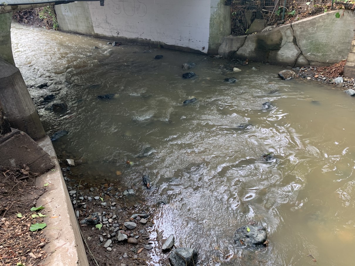
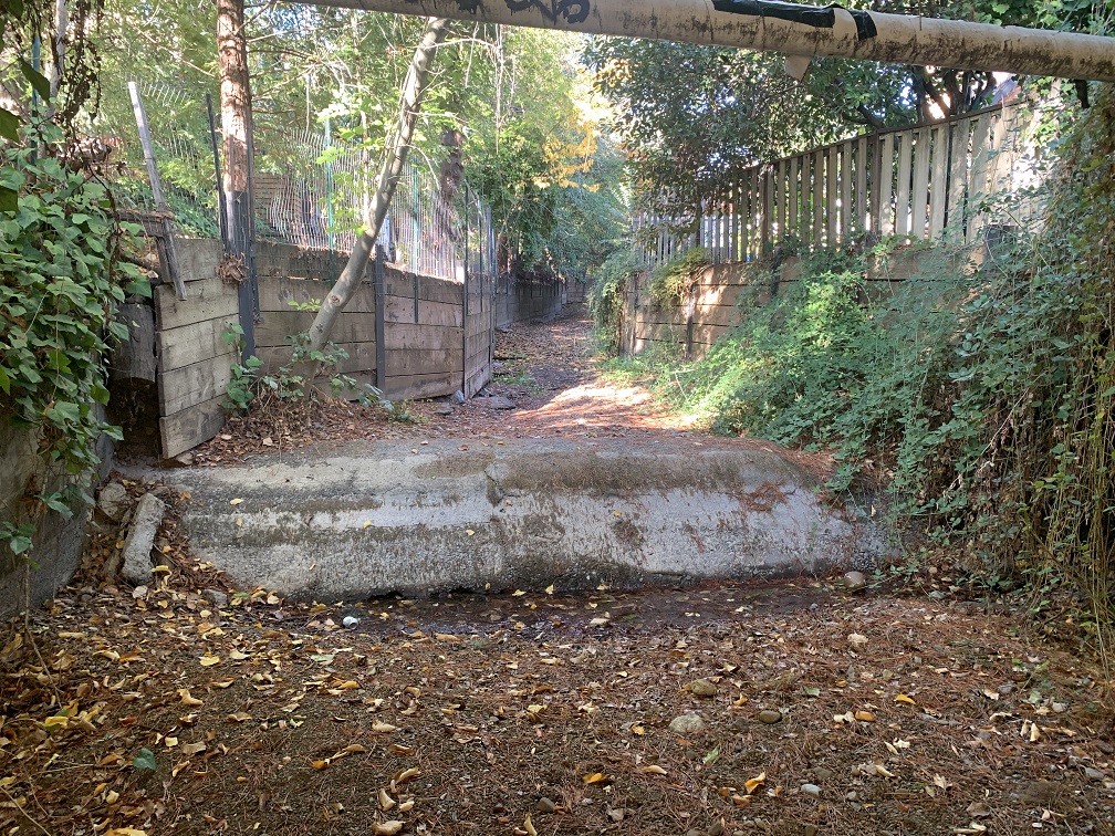
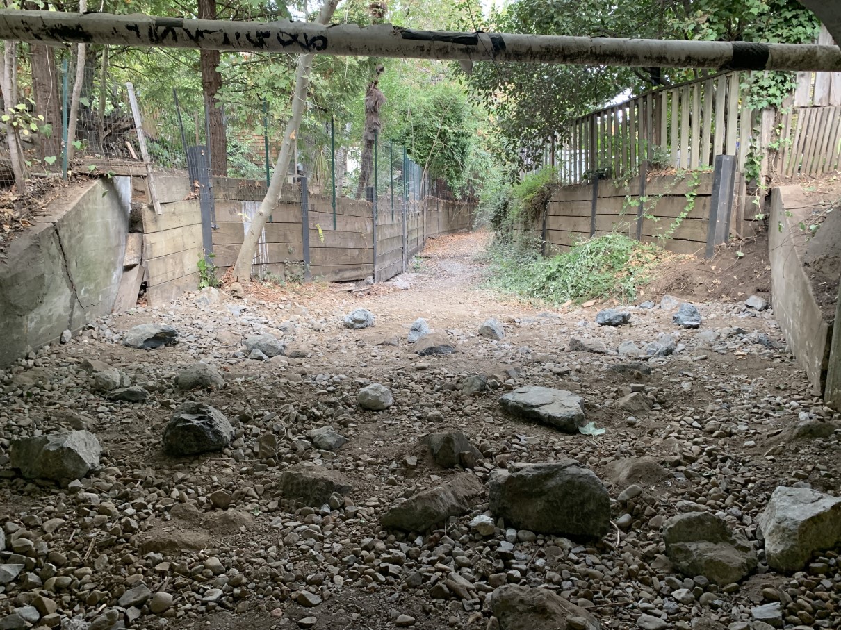
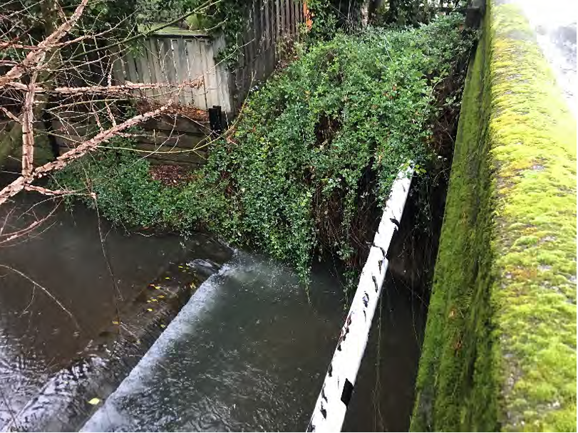
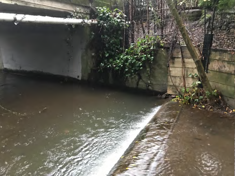
Project Description: In 2019, RVSD replaced an aging sanitary sewer line crossing the bed of Ross Creek with a deeper siphon pipe, but the abandoned 21-inch sewer line remained encased in a concrete weir on the creek bed. The concrete structure created a 3.5-foot dam — with an 18-inch drop from the top of the encasement to the water surface — that exceeded fish passage design criteria for younger age classes of steelhead and blocked smolt outmigration. This was the first barrier encountered by migrating steelhead entering from Corte Madera Creek. The project demolished and removed the concrete encasement and abandoned pipe, replaced the channel bed with native coarse cobble and boulders to restore natural grade and flow heterogeneity, and installed native riparian plantings with two-year irrigation to restore canopy cover and channel bank stability. A roughened channel design used boulders ranging from 12 to 28 inches to create an irregular, passable channel surface. Five years of annual monitoring for vegetation establishment and channel stability were included in the project scope.
Expected Completion: Construction September–November 2021; five-year monitoring program through 2026.
Project Effectiveness: The project successfully removed the one barrier on Ross Creek to all age classes of salmonids, restoring passage through 8,000 linear feet of upstream channel to a concrete arch culvert approximately 3,000 feet upstream — the next structure in the system. Riparian revegetation was designed to achieve 80–90% of pre-project canopy cover within five years, with performance monitored annually. Channel stability was assessed through thalweg surveys in Years 1, 3, and 5 post-construction, supplemented by annual visual inspections and fixed photo-monitoring stations.