Lower Stotenburg Creek Fish Passage Project
Project Lead: Smith River Alliance
Location of Project:
- Downstream End, Lat: 41.8895780; long: -124.1480910
- Crossing #1, Lat: 41.888267; long: -124.146431
- Crossing #2, Lat: 41.887927; long: -124.145719
- Crossing #3, Lat: 41.887054; long: -124.144423
- Crossing #4 at Cedar Lodge Lane: 41.88553; long: -124.141558
- Upstream End, Lat: 41.8849720; long: -124.1411400
Description of Project:
The Lower Stotenburg Creek Fish Passage Project will take advantage of a valuable opportunity to partner with private landowners to remove all barriers to fish passage along the downstream most 0.5 mile of Stotenburg Creek, while also increasing habitat complexity and improving the native riparian corridor. These actions will increase the quality and quantity of accessible productive coastal rearing habitat in the Smith River Plain. The project will improve the connection between Stotenburg Creek and the mainstem Smith River through treatment of barriers and impediments to salmonid upstream and downstream passage, by upgrading and/or removing four stream crossings.
Specific activities include:
-
- replacing two crossings and complete removal of two crossings that are known fish barriers
- installing an engineered log jam, large wood structures and re-contouring the channel to enhance connection to the mainstem Smith River
- building five beaver dam analogs to increase channel complexity and winter rearing habitat
- enhancing native riparian vegetation and cattle exclusion fencing throughout the 0.5 mile stream reach and project area.
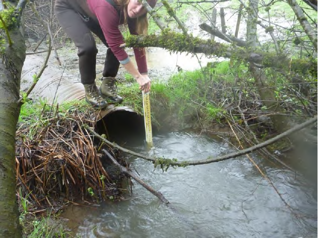
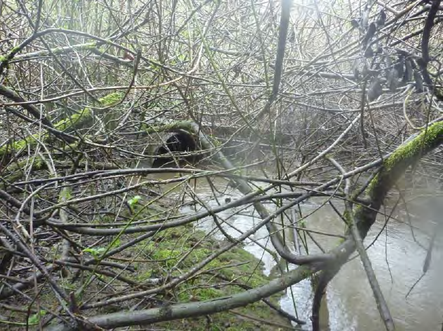
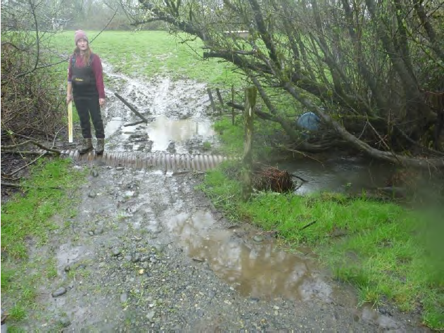
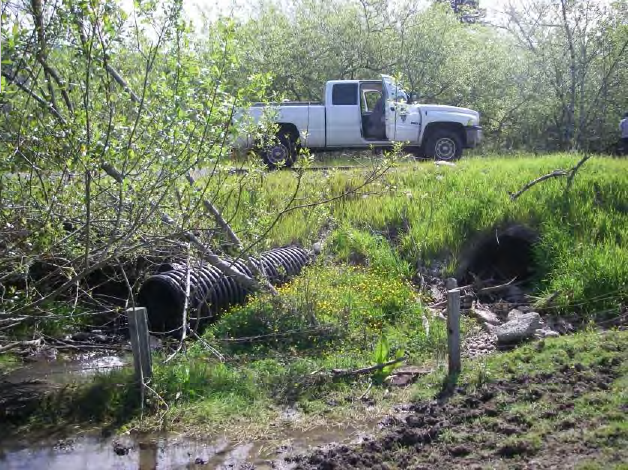
Stotenburg Creek is a small Smith River Plain tributary, with a watershed area of 452 acres, shown to provide important non-natal winter rearing habitat for juvenile Coho salmon (Parish and Garwood 2015 & 2016). The project will treat four barriers and passage impediments that extend from the confluence of Stotenburg Creek and the Smith River, to upstream of Cedar Lodge Lane (the 4th crossing from the mouth). Overall the project will reduce the number of stream crossings, decrease flow velocities through the project reach, inundate and create additional winter rearing habitat, and reduce the potential for stranding as the stream dries in the spring. The proposed project will meet CDFW and NOAA Fisheries fish passage criteria (see CA Restoration Manual, Part IX, Appendix A and B; and Volume II, Part XII) to the greatest extent possible at each site, allowing passage to all salmonid life stages. Crossing #1 will be converted to a bridge and have a natural channel bottom throughout the crossing site. Crossing #2 and #3 will be removed and restored to a natural channel. Crossing #4 (Cedar Lodge Lane) will convert four undersized culverts, set at various grades and lengths to a single aluminum box culvert buried below the streambed to create a natural channel bottom. Forum funding will be used to initiate and complete the CEQA and tribal consultation processes, as well as fund subcontractor work to remove the culvert at Crossing #2. Funds will also be used to initiate project management including but not limited to coordination and with the landowner, subcontractors, and agency representatives. Fish barriers at road crossings are listed as a high threat to juvenile and smolt Coho in the Smith River Plain. The majority of the barriers that exist in the Smith Coastal Plain are on private agricultural land that cumulatively impact access to vital rearing habitats. Implementation of the Lower Stotenburg Fish Passage Project and its easy access will serve as a site to educate other landowners and local restoration practitioners about ways to restore stream habitat while also serving the needs of the landowner. Funds from the Fish Passage Forum is key to advancing this project and ensuring implementation will occur by 2022.
