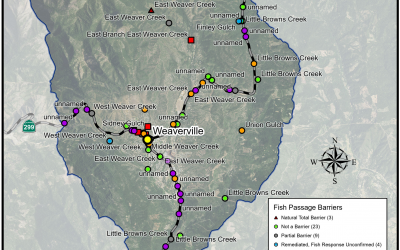
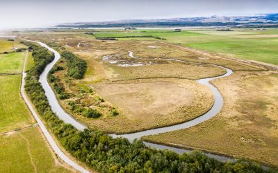
2024 ProjectsWeaver Basin Fish Passage Assessments Project Lead: Trinity County Resource Conservation District Location of Project: 40.746456, -122.945306 Description of Project: Weaver Creek, a tributary to the Trinity River, is one of the many headwater...
Back to Funded Projects
Jenny Creek Man-made Barrier Removal
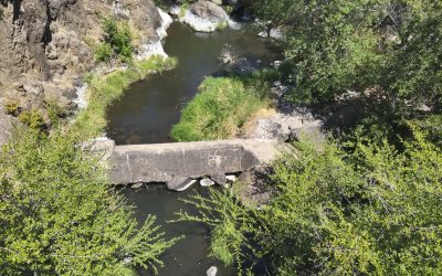
Jenny Creek Man-made Barrier Removal Project Lead: Trout Unlimited Location of Project: 41.953187, -122.382346 Description of Project: Small dams have been installed across the United States for storage, water irrigation, and flood protection. Over the years many of...
Native Fish Passage in San Joaquin River at Eastside Bypass Control Structure
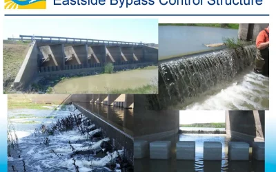
Native Fish Passage in San Joaquin River at Eastside Bypass Control Structure Project Lead: US Fish and Wildlife Service Location of Project: Latitude: 37.205082, Longitude: -120.697574 Description of Project: For over 60 years, the San Joaquin River saw no...
Lower Stotenburg Creek Fish Passage Project
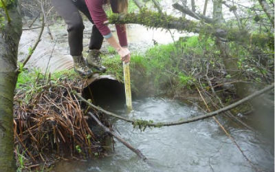
Lower Stotenburg Creek Fish Passage Project Project Lead: Smith River Alliance Location of Project: Downstream End, Lat: 41.8895780; long: -124.1480910 Crossing #1, Lat: 41.888267; long: -124.146431 Crossing #2, Lat: 41.887927; long: -124.145719 Crossing #3, Lat:...
Fish Passage Project Media Acquisition Effort
Fish Passage Project Media Acquisition Effort Project Lead: Fast and Light Productions Location of Project: Various locations TBD throughout the state of California Description of Project: This media acquisition project will bolster the Forum’s ability to communicate...
Lamprey Passage Design for Priority Obstacles in the Sacramento Basin (Phase 2)
Lamprey Passage Design for Priority Obstacles in the Sacramento Basin (Phase 2) Project Leads: Western Fishes & US Fish & Wildlife Service Location of Project: 39.7004 N 121.94237 W - Sacramento Valley below impassable dams Description of...
West Tule Creek Diversion Fish Passage Project
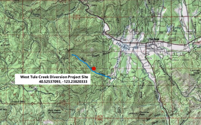
West Tule Creek Diversion Project Lead: Water Resource and Training Center Location of Project: 40.52537093, -123.23820333 Description of Project: The Water Resource and Training Center (WRTC) in coordination with project partners propose to address fish passage...
Montague-Granada Weir Retrofit & Barrier Removal
Montague-Grenada Weir Retrofit & Barrier Removal Project Lead: Shasta Valley Resource Conservation District Location of Project: -122.538155, 41.709014 Description of Project: The Montague-Grenada Weir (sometimes called the Watermaster's Weir or the USGS Weir) is...
Strawberry Creek at Clam Beach Fish Passage Remediation Project
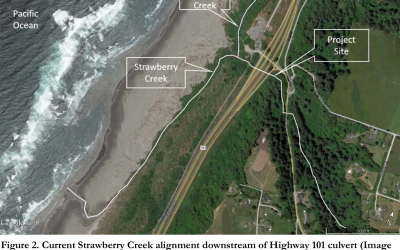
Strawberry Creek at Clam Beach Fish Passage Project Project Lead: Trout Unlimited Location of Project: 40.993609, -124.113184 Description of Project: The goal of this project is to provide fish passage through the existing concrete channel upstream and adjacent to...
Applying FISHPass In the Smith River Watershed
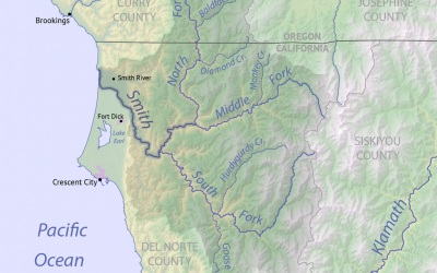
Applying FISHPass In the Smith River Watershed Project Lead: Ross Taylor and Associates Location of Project: Smith River watershed in Del Norte County, California. (41.79558, 124.05775 at South Fork confluence.) Description of Project: The primary objective of...
Lamprey Passage Design for Priority Obstacles in Sacramento Basin (Phase 1)
Lamprey Passage Design for Priority Obstacles in the Sacramento Basin (Phase 1) Project Lead: Western Fishes Location of Project: 39.7004° N 121.94237° W - Sacramento Valley below impassable dams Project Description: Obstructed passage is the primary threat to...
Lamprey Passage at Rowdy Creek
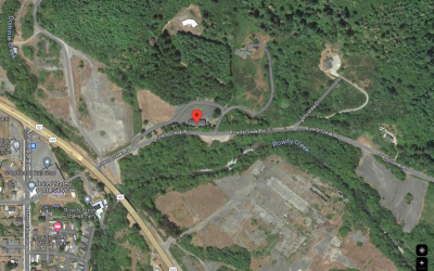
Lamprey Passage at Rowdy Creek Project Lead: Tolowa Dee-ni' Nation Location of Project: 41.928023, -124.143988 Description of Project: This project will provide passage for Pacific Lamprey over a diversion barrier through the installation of California-style lamprey...
Benbow Dam Removal
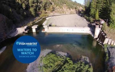
Benbow Dam Removal In 2017 this project was selected as one of NFHP's annual list of 10 Waters to Watch. Learn more here Project Lead: California State Parks Location of Project: 40.06566100, -123.80127200 Description of Project: This project will remove Benbow Dam to...
Pacific Lamprey Passage Assessment Database Project
Pacific Lamprey Passage Assessment Database Project Principal Investigator(s): Stewart Reid (Western Fishes) and Damon Goodman, U.S. Fish and Wildlife Service (AFWO; Pacific Lamprey Conservation Initiative). Cooperators: PAD - Pacific States Marine Fisheries...
Manly Gulch Coho Access and Habitat Restoration Project
Manly Gulch Coho Access and Habitst Restoration Project Location of Project: 39.33505974 : -123.70058890 at the Manly Gulch crossing Description of Project: The project will consist of restoration and minor realignment of 600 feet of Manly Gulch, a tributary to the...
Kelly Gulch Fish Passage Project
Kelly Gulch Fish Passage Project Location of Project: 41°17’30” 123°10’0” Description of Project: Kelly Gulch is a perennial tributary of the North Fork Salmon River that contains Southern Oregon and Northern California Coast (SONCC) coho salmon, Klamath Mountains...
Wilson Creek Fish Passage Project
Wilson Creek Fish Passage Project Location: Wilson Creek, tributary to Hayfork Creek, tributary to South Fork Trinity River in the Shasta-Trinity National Forest. Purpose: The site had a seven-foot diameter corrugated metal pipe (CMP) culvert under a National Forest...

