
Montague-Grenada Weir Retrofit & Barrier Removal
Project Lead: Shasta Valley Resource Conservation District
Location of Project: -122.538155, 41.709014
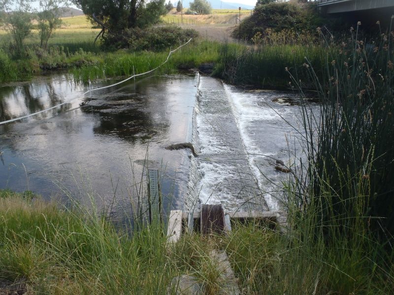
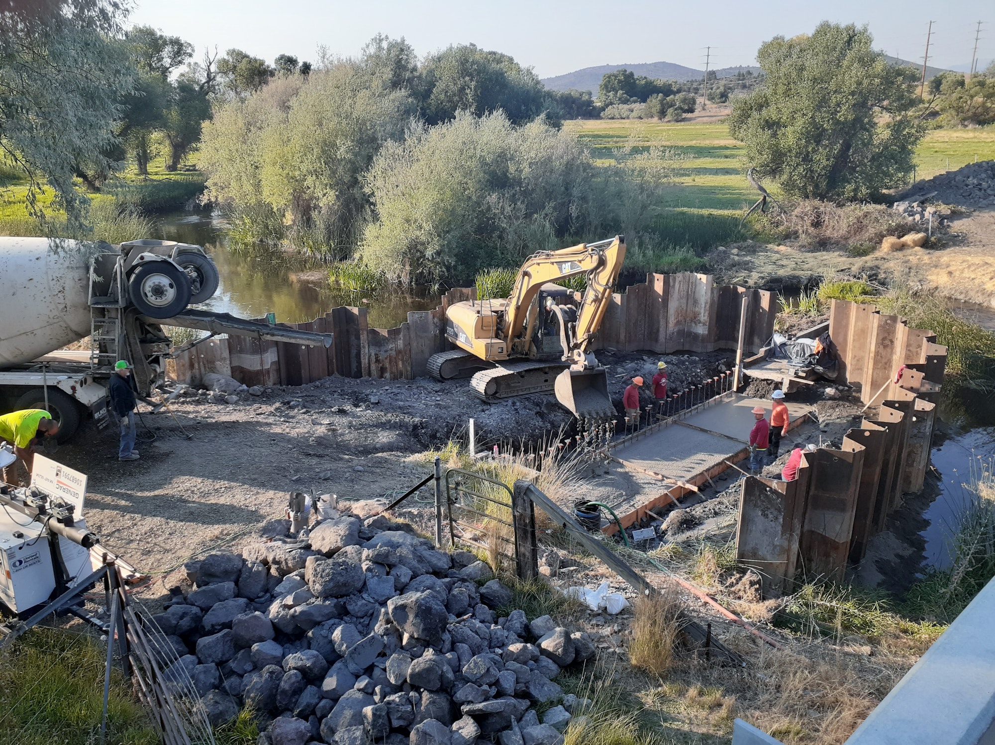
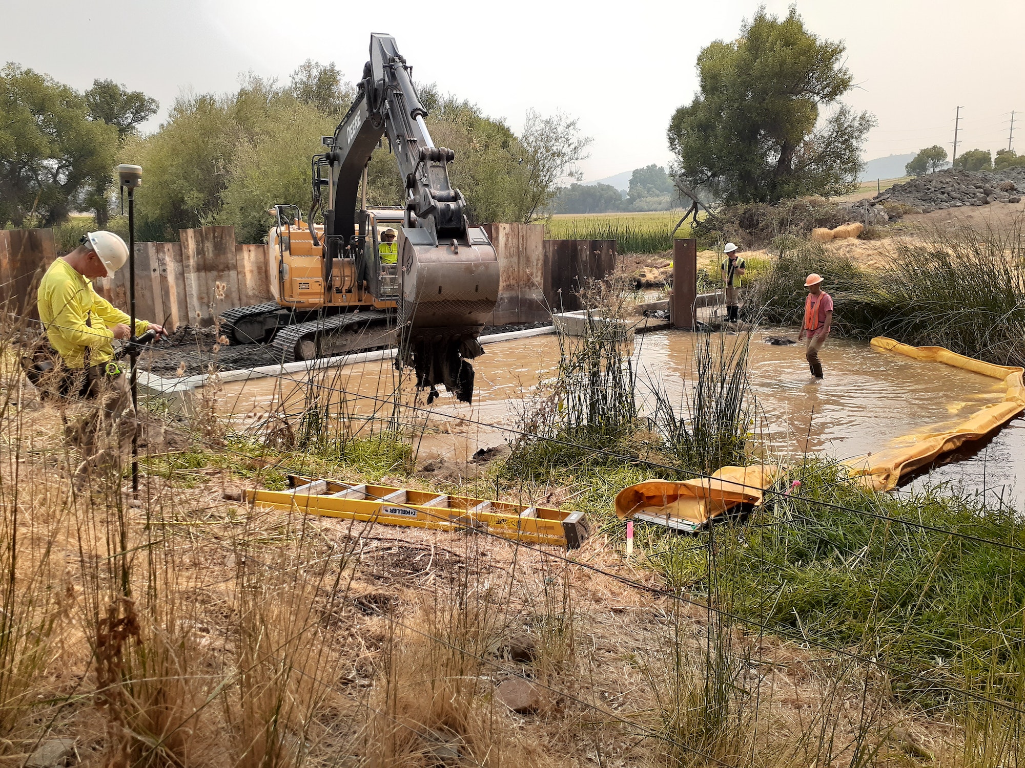
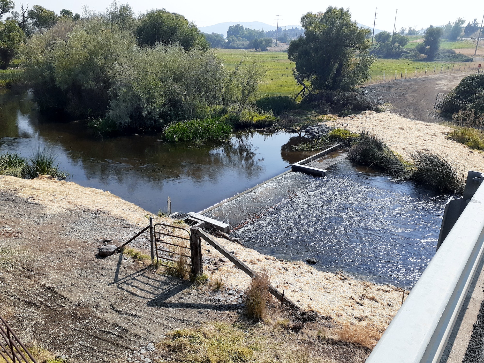
Description of Project: The Montague-Grenada Weir (sometimes called the Watermaster’s Weir or the USGS Weir) is an important Shasta River flow measuring structure at river mile 14.6. The weir, built in 1980, is a concrete structure that spans the open channel to improve flow measurements. It is currently managed in a cooperative manner by several local agencies including U.S. Geological Society (USGS), the Scott-Shasta Watermaster District (SSWD) and the Shasta Valley Resource Conservation District (SVRCD). Funds from the California Department of Water Resources (DWR) allows USGS to measure and provide accurate, realtime data to local irrigation districts and water users. These agencies seek to work together to improve ecosystem health in the Shasta River.
The project has two coequal goals:
- Preserve the integrity of open channel flow characteristics for SSWD and USGS services
- Improve fish passage for all life stages of salmon species, particularly juvenile salmon
The engineered weir modification design will meet both goals by the addition of a fishway to the weir, which will allow juvenile salmon to pass upstream to cooler refugia during low flows and when temperatures are sub-lethal in the mainstem Shasta. All permits have been secured, and 100% design issues have been resolved. The SVRCD has taken on the responsibility for maintenance and mangement of the weir for five years.