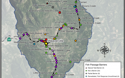
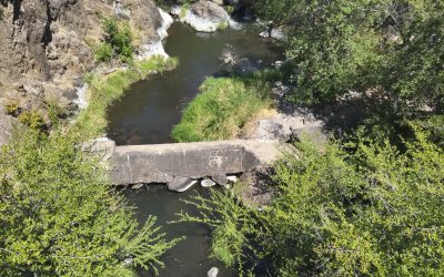
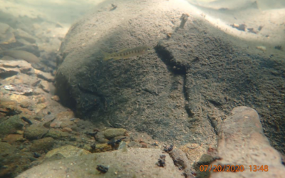
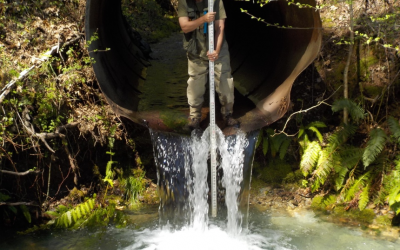
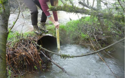
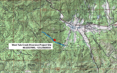
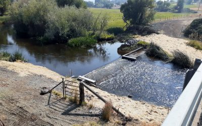
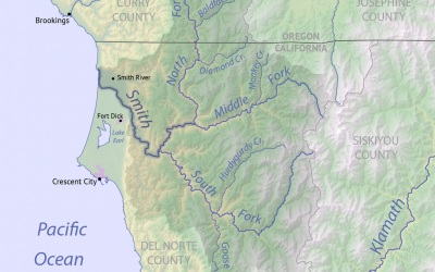
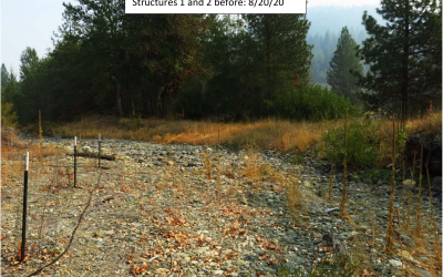
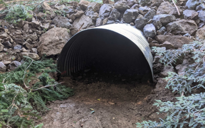
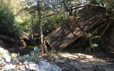
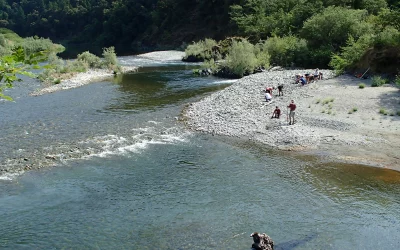
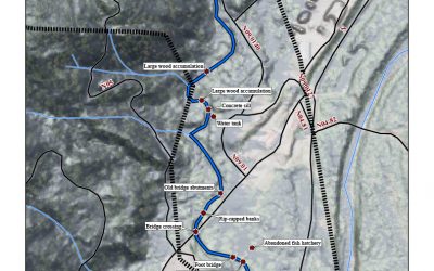
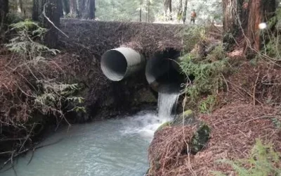
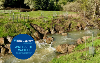
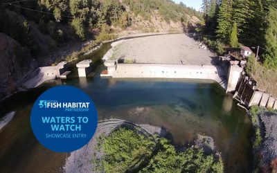
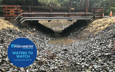
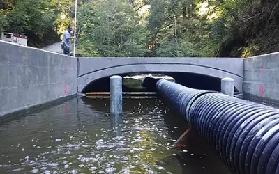
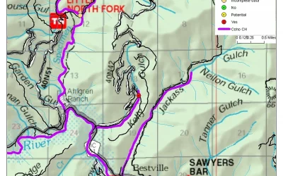
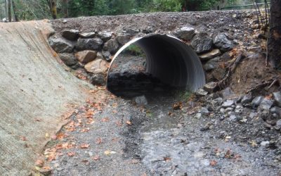
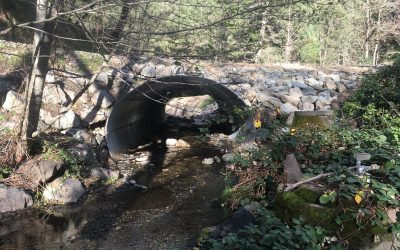
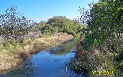
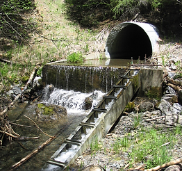
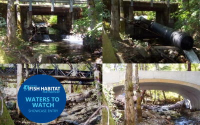
2024 ProjectsWeaver Basin Fish Passage Assessments Project Lead: Trinity County Resource Conservation District Location of Project: 40.746456, -122.945306 Description of Project: Weaver Creek, a tributary to the Trinity River, is one of the many headwater...
Back to Funded Projects
Jenny Creek Man-made Barrier Removal
Jenny Creek Man-made Barrier Removal Project Lead: Trout Unlimited Location of Project: 41.953187, -122.382346 Description of Project: Small dams have been installed across the United States for storage, water irrigation, and flood protection. Over the years many of...
Mid-Klamath Tributary Fish Passage Improvement Project
Mid-Klamath Tributary Fish Passage Improvement Project Project Lead: Salmon River Restoration Council Location of Project: 41.377561, -123.493405 Description of Project: Since 2001, the Salmon River Restoration Council (SRRC) and the Mid Klamath Watershed...
North Fork Ryan Creek Fish Passage Design
North Fork Ryan Creek Fish Passage Design Project Lead: Eel River Watershed Improvement Group Location of Project: 39.483544, -123.360645 Description of Project: This fish passage project is on North Fork Ryan Creek, which is a tributary to Ryan Creek, a...
Little Case Fish Passage Project
Little Case Fish Passage Project Project Lead: Eel River Watershed Improvement Group Location of Project: 39.68385° N, -123.51815° W Description of Project: Little Case Creek is a tributary to Tenmile Creek, one of the largest tributaries to the South Fork Eel...
Lower Stotenburg Creek Fish Passage Project
Lower Stotenburg Creek Fish Passage Project Project Lead: Smith River Alliance Location of Project: Downstream End, Lat: 41.8895780; long: -124.1480910 Crossing #1, Lat: 41.888267; long: -124.146431 Crossing #2, Lat: 41.887927; long: -124.145719 Crossing #3, Lat:...
Lawrence Creek Off Channel Habitat Connectivity Project (Phase 3)
Lawrence Creek Off Channel Habitat Connectivity (Project Phase 3) Project Lead: Trout Unlimited Location of Project: 40.5988, -123.9785 Description of Project: This project will occur within Lawrence Creek, a high priority, core recovery salmon and steelhead stream in...
Fish Passage Project Media Acquisition Effort
Fish Passage Project Media Acquisition Effort Project Lead: Fast and Light Productions Location of Project: Various locations TBD throughout the state of California Description of Project: This media acquisition project will bolster the Forum’s ability to communicate...
Mid Klamath Creek Mouth Enhancement Project
Mid-Klamath Creek Mouth Enhancement Project Project Lead: Mid Klamath Watershed Council Location of Project: 41.30222, -123.53805 Description of Project: Since 2001, the Mid Klamath Watershed Council (MKWC), Karuk Tribal Fisheries Program (KTFP), the Salmon...
West Tule Creek Diversion Fish Passage Project
West Tule Creek Diversion Project Lead: Water Resource and Training Center Location of Project: 40.52537093, -123.23820333 Description of Project: The Water Resource and Training Center (WRTC) in coordination with project partners propose to address fish passage...
Montague-Granada Weir Retrofit & Barrier Removal
Montague-Grenada Weir Retrofit & Barrier Removal Project Lead: Shasta Valley Resource Conservation District Location of Project: -122.538155, 41.709014 Description of Project: The Montague-Grenada Weir (sometimes called the Watermaster's Weir or the USGS Weir) is...
Applying FISHPass In the Smith River Watershed
Applying FISHPass In the Smith River Watershed Project Lead: Ross Taylor and Associates Location of Project: Smith River watershed in Del Norte County, California. (41.79558, 124.05775 at South Fork confluence.) Description of Project: The primary objective of...
Upper Noyo River – Skunk Train
Upper Noyo River - Skunk Train Project Lead: Trout Unlimited Location of Project: 39.4183825, 123.4310594 Description of Project: The objective of this project is to restore access to 1.15 miles of steelhead and salmon habitat upstream of the upper Noyo River railway...
Seiad Creek Off-Channel Connection Project
Seiad Creek Off-Channel Connection Project Project Lead: Mid Klamath Watershed Council Location of Project: Durazo Pond: 41°50'44.44"N, 123°11'24.86"W Stender Pond: 41°51'12.50"N, 123°10'8.05"W Alexander Pond: 41°51'15.26"N, 123°10'1.63"W Description of Project: This...
M-1 Road Fish Passage Improvement Project
M-1 Road Fish Passage Improvement Project Project Lead: Trout Unlimited Location of Project: 39.29675, -123.71789 Description of Project: This project intends to remove and replace one stream crossing along the California State Parks, Big River Unit, M-1 Road. The...
Iron Horse Vineyards Dam Removal Project
Iron Horse Vineyards Dam Removal Project Project Lead: Gold Ridge Resource Conservation District Location of Project: 38.462605 -122.89656 Description of Project: Located in western Sonoma County, Green Valley Creek is considered a vitally important anadromous...
Mid-Klamath Fish Passage Improvement Project
Mid Klamath Fish Passage Improvement Project Location of project: Weitchepec, CA (41.1856, -123.708611) to Cottonwood Creek (41.8881666667, -122.5438750000) Forum Funding Received: $38,680 Description of Project, including deliverables: Since 2001, the Mid Klamath...
Cooper Mill Fish Passage Improvement Project Design
Cooper Mill Fish Passage Improvement Design Location of Project: Downstream Project Extent -40.55923000 : -124.05789000 - Cooper Mill and Yager Creek confluence, Map COMPLETED: The objective of this project is to develop preliminary site characterizations that will...
Neefus Gulch Coho Salmon Barrier Removal Project Design at Appian Way
Neefus Gulch Coho Salmon Barrier Removal Project Design at Appian Way Location of Project: 39.17875000 : -123.57107000 - Earthen Barrier Forming Pond 39.17592000 : -123.56846000 - Appian Way Culvert Barrier COMPLETED: This project developed engineered designs for a...
Upper Green Valley Creek Fish Passage Project
Upper Green Valley Creek Fish Passage Project In 2019 this project was selected as one of NFHP's annual list of 10 Waters to Watch. Learn more here. Project Photos Project Update: July 2018 Project Lead: Gold Ridge Resource Conservation District Location of...
Benbow Dam Removal
Benbow Dam Removal In 2017 this project was selected as one of NFHP's annual list of 10 Waters to Watch. Learn more here Project Lead: California State Parks Location of Project: 40.06566100, -123.80127200 Description of Project: This project will remove Benbow Dam to...
Manly Gulch Coho Access and Habitat Restoration Project
Manly Gulch Coho Access and Habitst Restoration Project Location of Project: 39.33505974 : -123.70058890 at the Manly Gulch crossing Description of Project: The project will consist of restoration and minor realignment of 600 feet of Manly Gulch, a tributary to the...
Memorial County Park Fish Passage Barriers Remediation Project
Memorial County Park Fish Passage Barriers Remediation Project Project Lead: San Mateo RCD Video: http://www.sanmateorcd.org/project/memorial-park-fish-passage/ Location of Project: 37.16’26928, -122.17311 Description of Project: This project will modify the two...
Kelly Gulch Fish Passage Project
Kelly Gulch Fish Passage Project Location of Project: 41°17’30” 123°10’0” Description of Project: Kelly Gulch is a perennial tributary of the North Fork Salmon River that contains Southern Oregon and Northern California Coast (SONCC) coho salmon, Klamath Mountains...
Dinner Creek Fish Migration Barrier Removal Project
Dinner Creek Fish Migration Barrier Removal Project Location of Project: 40.091508 N, -123.935992 W Description of Project: The project replaces fish migration barrier culverts with natural bottom installations that meet NOAA fish passage design criteria. Removal of...
Sharber-Peckham Fish Passage Project
Sharber-Peckham Fish Passage Project Location of Project: 40º53’45”N Lat, 123º33’38”W Long Description of Project: The proposed project will replace an undersized culvert which has created a migration barrier to anadromous fish species on Sharber/Peckham Creek. This...
Salt River Ecosystem Restoration Project
Salt River Ecosystem Restoration The Salt River Watershed is located in coastal northern California in the Eel River Delta. The watershed extends from the Wild Cat Mountains on the south, to the Eel River on the north. A fertile agricultural valley lies between. Due...
Branciforte Creek Dam Removal
Branciforte Creek Dam Removal Location: The dam is located at 4361 Branciforte Drive, Santa Cruz, CA 95061 in Branciforte Creek. The GPS coordinates are 37°02’16.51” N 121°59’07.48” W. Purpose: Passage barriers for diadromous fish in Santa Cruz County remain one of...
Wilson Creek Fish Passage Project
Wilson Creek Fish Passage Project Location: Wilson Creek, tributary to Hayfork Creek, tributary to South Fork Trinity River in the Shasta-Trinity National Forest. Purpose: The site had a seven-foot diameter corrugated metal pipe (CMP) culvert under a National Forest...
Conner Creek Fish Passage Improvement Project
Conner Creek Fish Passage Improvement Project In 2012 Conner Creek was selected as one of NFHP’s annual list of 10 Waters to Watch. Read more here Project Location: Conner Creek is a tributary to the Trinity River below Lewiston Dam. The project is located in T 33N, R...